
The Oboz Trail Experience is a challenge to hike or run a certain number of predetermined local(ish) trails within a month. With only seven locations this year, I was surprised that Charlottesville made the cut (among the likes of Bozeman, MT, Burlington, VT, and Fort Collins, CO.) I’m assuming it’s because a new Public Lands just opened here.
Total distance varied by location. For Charlottesville, there were 22 trail segments totaling 101.52 miles to be completed within the month of October. It’s free to sign up and all you have to do is connect an Activity Tracking account and the website updates automatically once you complete a segment. The trail segments ranged from 1.76 miles to 13.29 miles. Some are flat and relatively easy and some are mountainous and technical. The combined elevation gain for all 101.52 miles was 30,516 feet.
I was worried about the technical aspect (figuring out how to connect and sync my Garmin) because it’s not something I’m great at, but it was easy and everything went (relatively) smoothly.
I can’t upload (download? I’m clueless.) maps to my Garmin, and the challenge did seem to assume that you could do that. I had to put some effort into figuring out where I was actually supposed to go once I was out there. Luckily, I was familiar with all but two of the trails. But the exact route I needed to take for the challenge often differed from the one(s) I usually take. I ended up with a few bonus miles as a result, but that just added to the challenge.
It was fun to monitor everyone’s progress on the Oboz Trail Experience website. There is a map of all of the included trail segments that switch from red to green once you complete them. You can click on each participant’s name and see their map and which trails they’ve completed. There’s also a Facebook page where you can share pictures, ask questions and interact with other participants.
Oboz and Public Lands donate $10 to local nonprofits (Ivy Creek Foundation, Rivanna Trails Foundation, and Shenandoah National Park Trust for the Charlottesville one) every time someone completes an associated promoted trail segment.
There are also several promoted trail segments that you get prizes for completing. I think you pick them up at Public Lands, but I haven’t done that yet. I’m trying very hard not to accumulate things I don’t need. One of the prizes was a pair of Farm to Feet socks that I could actually use, so I may try to pick them up at some point.
I ran most of the segments but did some hiking too. Running isn’t allowed at Ivy Creek so I had to hike that one. Once I started the challenge, my competitive edge took over and I wanted to finish as quickly as I could. Since I don’t usually run every day and was worried I would end up injured if I did, I hiked some of the segments so I could complete more of them each week.
The only bad thing about this challenge is all of the driving involved. I’ve cut way back on how much I drive for environmental and economic reasons. I typically only need to fill my gas tank once a month at most. I was filling it weekly during the challenge.
Getting out on so many trails did wonders for my mental health though. I may need to let go of some of the guilt and drive to more trails. Trail running makes me happy.
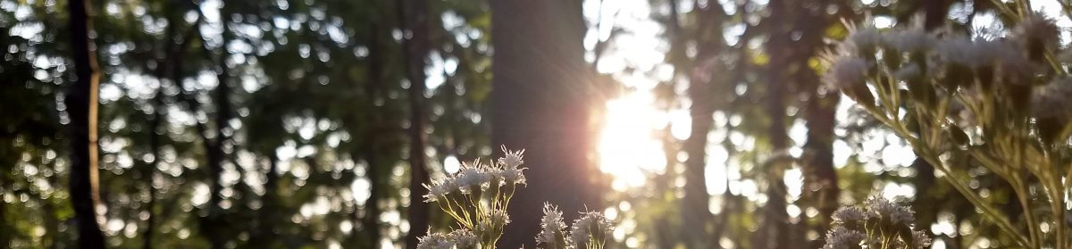
The challenge got me back to some of my favorite trails that I haven’t been to in a while. I loved watching the sunrise from Turk mountain.

Walnut Creek used to be my favorite place to run and I hadn’t been there in over a year.

It also got me out on trails that I love but tend to avoid running on because they’re so technical (Three Ridges and Riprap/Wildcat.)


I always try to run Riprap/Wildcat in the spring when the Rhododendrons are blooming but it is equally spectacular in the fall.
Overall, I didn’t run more miles than I normally would have during the challenge, but I did run more trail miles. I also did more hiking and a lot more climbing.
The sections of the Rivanna Trail included in the challenge made me realize that I really should take advantage of it more than I do. The Rivanna Trail is a twenty-mile singletrack loop around Charlottesville. It’s a great perk that I tend to take for granted.

There was an afterparty at Public Lands with free food and Oboz shoe giveaways. I was in Montebello getting ready to run Mountain Masochist that night, so I wasn’t able to attend. Although if I’m being honest, I wouldn’t have gone anyway. Social things are hard.


